Weather: Met Office predicts cold and mild conditions
We use your sign-up to provide content in ways you’ve consented to and to improve our understanding of you. This may include adverts from us and 3rd parties based on our understanding. You can unsubscribe at any time. More info
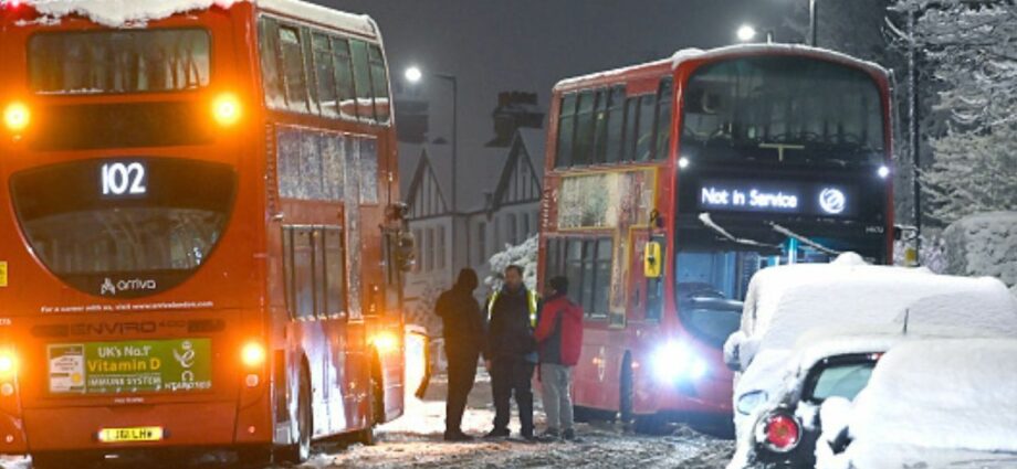
Speculation surrounding the prospect of the UK being battered by a chaotic Beast from the East weather system has been doubted by the Met Office. At least two independent forecasters, and interactive weather maps, show the nation blanketed by snow in the first week of February. But the country’s leading meteorologists are refusing to confirm or deny anything of the sort is showing up on its radars. According to WXCHARTS, February 7 will be the worst day of the second cold snap of the year, with snow reaching nearly every corner of the four nations.

Jim Dale, a senior meteorologist for British Weather Services says he predicts another icy snap could begin ramping up from February 2 with the potential for it lasting a week. WXCHARTS also shows temperatures starting to tumble on this date.
On Sunday, February 5 a band of heavy rain can be seen pushing eastwards off the Atlantic which will then turn to snow for some of the colder parts of the country. Then come Monday, February 6 the mercury starts to drastically plunge with lows of -4C in Manchester and -12C in Fort William, Scotland.
By this point three quarters of the nation will be under some thickness of snow – and it appears the Scottish Highlands are predicted to have up to 50cm blanketed across the rural area.
The south-east, however, appears to miss much of the commotion – with the south west and the Midlands potentially getting a dusting at least.


Brian Gaze, from The Weather Outlook, is just one of the forecasters who is keeping tabs on how this frontal system could develop. He said to Express.co.uk: “Computer models are suggesting that a weakening of the Stratospheric Polar Vortex (SPV) in the coming weeks could lead to an increasing chance of cold weather during February.
But spokeswoman for the Met Office, Nicola Maxey, said there is a “consistent signal” which indicates unsettled weather conditions on the horizon from late January and into February – which are more so anchored on rain and strong winds.
Speaking to Express.co.uk she said: “There’s a consistent signal for some further rain and wind through late January and into February. The current forecast for early February shows high pressure likely near southern areas of the UK, bringing more settled conditions to the south but with more unsettled weather more prevalent further north.


“Temperatures are most likely to be near average in the first half of the month, albeit with some colder spells possible for a time.” Ms Maxey was unable to confirm if the colder spell would indeed include snow.
Adding more background information as to how the Met Office comes to its weather conclusions, she said: “Forecasting the weather accurately relies on a combination of cutting edge forecasting models and the skill of interpreting these models by expert meteorologists.
“The Met Office runs several models many times, instead of just once, from very slightly different starting conditions. The range of different outcomes gives us a measure of how confident or uncertain we should be in the overall forecast. This is called ensemble forecasting.
“At this point in time I have no indication of wide spread snow in the forecast but this does not mean we will not see any snow at all, particularly over higher ground in the north. We will have to wait until closer to the time period for such details.”
From Saturday, January 28 to February 6 the Met Office’s long range weather forecast says: “On Saturday, cloud and patchy rain are likely across the south, this clearing during the afternoon.
“A mixture of sunny spells and showers is expected further north, but with further clouds and outbreaks of rain and drizzle spreading towards northern and northwestern areas later. For the rest of the period, variable amounts of cloud, and often dry conditions are expected in most parts of the UK.
“However, rain bearing weather systems are likely to spread from the west or northwest at times. As a result, rain and wintry showers are expected to be focused in the north and northwest, with southeastern areas predominantly dry.
“Strong winds with gales are possible in the far north. Temperatures generally will be near normal overall, with overnight frosts possible under the clearer spells.”
Source: Read Full Article
-
Zelensky slams Berlusconi over former Italian PM’s support to Putin
-
Bosses who rolled out four-day working week face calls to scrap scheme
-
China warship accused of ‘dangerous, unsafe and unprofessional’ behaviour
-
UK weather map shows which towns and cities will have white Christmas
-
I was mauled by shark that clamped me like a bear trap in SIXTH attack along popular US coastline | The Sun