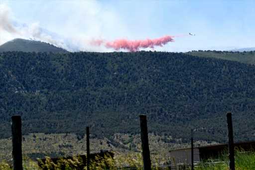
The Spring Creek fire burning in western Colorado south of Parachute expanded overnight and firefighters carried hydrogen sulfide gas detectors as flames spread close to oil and gas facilities, federal authorities said Thursday morning.
The most recent mapping of the fire showed that it is burning within a 2,985-acre area (4.7 square miles), based on overnight aerial infrared imagery, the federal Bureau of Land Management officials said Thursday morning.
It was one of at least four fires burning around Colorado as hot, dry, and windy conditions favored flames.
In southwestern Colorado, two fires were burning on the San Juan National Forest near Pagosa Springs in Archuleta County, and another was burning on Southern Ute land.
Spring Creek fire
Firefighters on the Spring Creek fire were relying on aircraft – helicopters lugging water and tankers loaded with fire retardant red slurry – in their efforts to contain and suppress flames, BLM spokesman Eric Coulter said in an emailed response to queries.
The proximity to oil and gas industry wells and other infrastructure complicated firefighting.
“The fire has burned around some pads, but no damage,” Coulter said.
“Most of the oil and gas infrastructure has good cleared space,” he said. A highly toxic and flammable gas, hydrogen sulfide, that potentially could be released “has caused us to have portable monitors for crews within proximity.”
No injuries have been reported on this fire, which broke out June 24 on private land in Garfield County southwest of Parachute and spread eastward into the White River National Forest. How the fire ignited hasn’t been determined. No evacuations were ordered.
“Air operations have been extremely helpful to keep the fire line in check and will be continued to be used where necessary,” Coulter said. “High winds have limited some fixed-wing use.”
Coalmine fire
Firefighters in southwestern Colorado on Thursday were facing the Coalmine fire in Archuleta County, which has burned across about 40 acres, according to the latest information from the sheriff’s office. Ground crews were working to suppress it after aircraft were diverted to other fires.
Chris Mountain fire
About 12 miles west of Pagosa Springs, the Chris Mountain fire was burning on about 120 acres of national forest land, devouring Ponderosa pine and other trees, according to the latest information posted on a federal fire data website. Local authorities ordered evacuations in the area.
Firefighters planned to scout the fire Thursday and figure out how “to safely and effectively contain the fire,” authorities wrote in their latest update.
Arkansas Loop fire
Another fire burning on Southern Ute land, identified as the Arkansas Loop fire, expanded overnight and was burning on 126 acres Thursday morning, according to a bulletin from Southern Ute spokeswoman Summer Begay.
Bureau of Indian Affairs firefighting crews, along with Southern Ute and other local teams, were working to contain the fire, Begay said. Firefighting coordinators had requested up to 100 firefighters, she said. Ground firefighters have been counting on aircraft dropping water and slurry “given the steep and rugged nature of the terrain.”
Source: Read Full Article
-
Paul Silas dies — 3-time NBA champion and longtime coach was 79
-
Read the best extracts from Jeremy Clarke's much-loved Low Life column
-
Trump prepares for court appearance as 1st ex-president to face federal criminal charges – The Denver Post
-
Elon Musk spotted ‘recruiting volunteers for flight to Mars’ at World Cup Final
-
Lion brutally attacks hyena in front of tourists – but then its pack fights back

